Featured

Autonomous Mapping and Inspection Vehicle Capability

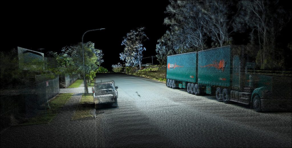
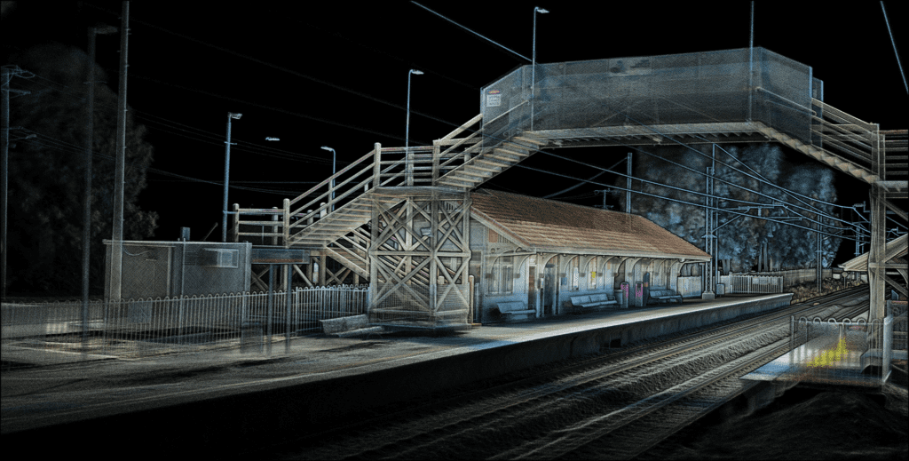
Autonomous Robotic Inspection Vehicle Linkedin Facebook Instagram Youtube    Reading time:  3 Minutes  Find out more 16/03/23 Written By #Marketing Remote Inspection In today’s fast-paced and ever-evolving world of mining and construction, having a remote inspection capability that is readily available can prove invaluable in times of uncertainty. For this reason BIA5 and AutoMap have …

Autonomous Mapping and Inspection Vehicle Capability Read More »

Odometric Comparison of Linear Surface Environment

Odometric Comparison of Linear Surface Environment Linkedin Facebook Instagram Youtube Reading time:  4 Minutes Download Data 09/01/23 Written By Shaun Coghlan The Experiment The importance of accurate and repeatable mapping is critical in many industries, which is why surveyors have historically been hesitant to use SLAM systems for surface-level applications due to concerns about error …

Odometric Comparison of Linear Surface Environment Read More »

TerrusM Odometric Repeatability in Subterranean Areas​

TerrusM odometric repeatability in subterranean areas Linkedin Facebook Instagram Youtube    Reading time:  4 Minutes  Download Data 09/12/22 Written By Shaun Coghlan Surveyors are typically wary of using SLAM systems in challenging spaces for fear of the lack of repeatability in quantifying error and capturing inaccurate data within the pointclouds. Much like a camera in …

TerrusM Odometric Repeatability in Subterranean Areas​ Read More »

Detailed LiDAR Capture in Drone-Denied Areas

Detailed LiDAR Capture in Drone-Denied Areas Linkedin Facebook Instagram Youtube    Reading time:  4 Minutes  Download Data 30/11/22 Written By Shaun Coghlan As more forms of mobile scanning have appeared over the years, One method of LiDAR capture has always ruled the sky. But what happens when the skies are off-limits? While drone-based LiDAR capture …

Detailed LiDAR Capture in Drone-Denied Areas Read More »

Ground Capture of Complex Infrastructure Using SLAM Systems

Ground Capture of Complex Infrastructure Using SLAM Systems Linkedin Facebook Instagram Youtube Reading time:  3 Minutes 31/10/22 Written By Shaun Coghlan Mapping Made Simple When it comes to capturing large and complex infrastructure, many companies are seeing a slow turn away from static LiDAR Scanners. Trading in their 200+ static setups for an hour of …

Ground Capture of Complex Infrastructure Using SLAM Systems Read More »

AutoMap Makes Its Europe Debut At InterGeo2022!​

AutoMap Makes Its Europe Debut At InterGeo2022! Linkedin Facebook Instagram Youtube Reading time:  3 Minutes 19/10/22 Written By Shaun Coghlan More excited than kids on Christmas eve, the team at AutoMap have eagerly been waiting all year to attend Germany’s biggest Geo data conference, InterGEO! Sending members from their Brisbane and California branches this Australian-based …

AutoMap Makes Its Europe Debut At InterGeo2022!​ Read More »

Conforming SLAM Maps to Survey Requirements Without GPS 2022

Conforming SLAM Maps to Survey Requirements Without GPS Linkedin Facebook Instagram Youtube Reading time:  4 Minutes 28/09/22 Written By Shaun Coghlan The Next Generation Of Subterranean Mapping As surveying equipment continues to improve, Automap continues to lead the SLAM industry with their latest in underground mapping solutions. Their best in class system, the TerrusM, allows …

Conforming SLAM Maps to Survey Requirements Without GPS 2022 Read More »

Scroll to Top

Want more information?

Enter your name and email below to keep up to date with the latest releases and offerings from AutoMap.