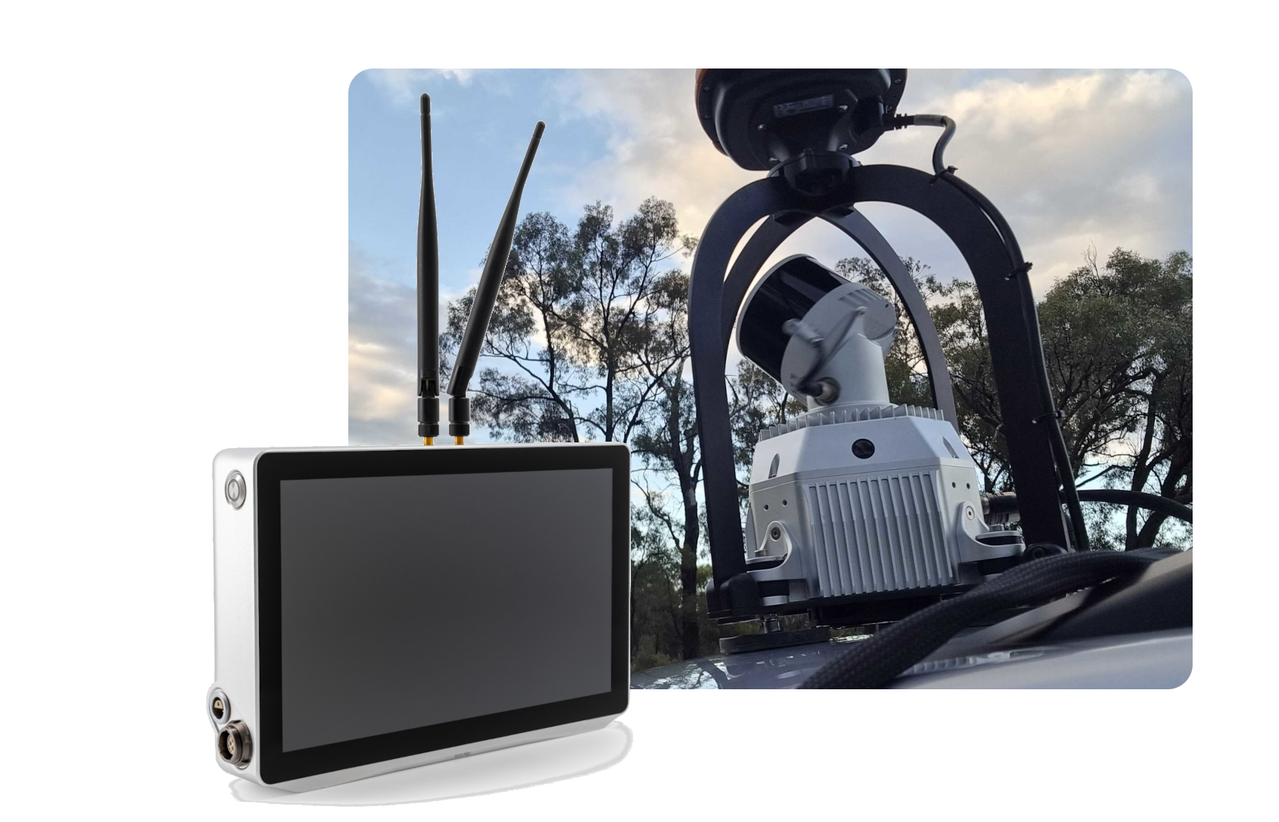
Transition between RTK GPS available and denied environments.
Enjoy the benefit of RTK GPS in open spaces and the isotropy of occlusive structure in environments where GPS is typically challenged.
Seamlessly transition between the two environments using RTK GPS aided SLAM to create accurate maps of GPS challenged environments. Take advantage of the ultra-low drift WildcatSLAM mapping engine to avoid having out to lay out pesky control indoors.
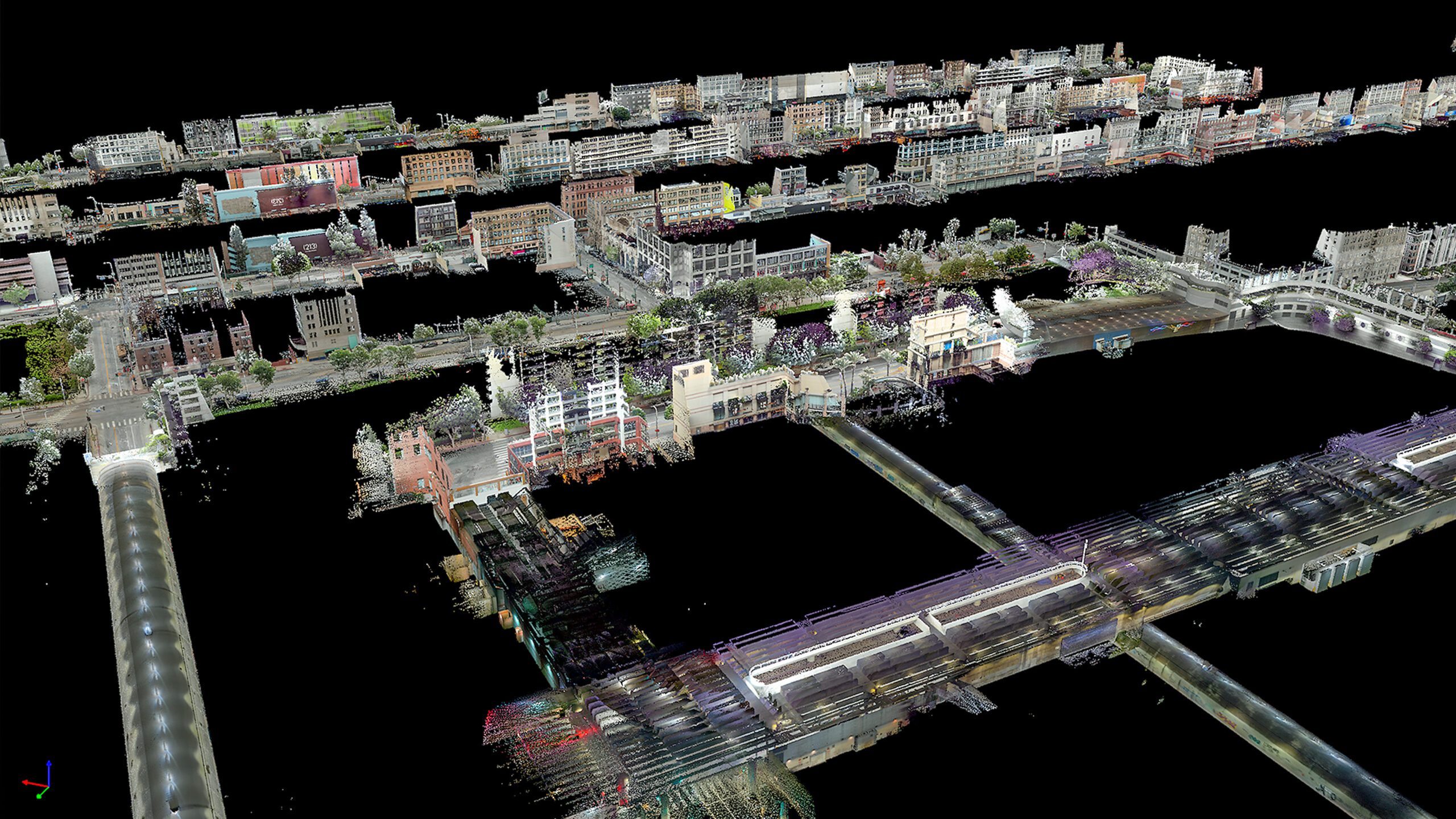
Urban and busy city scape spaces have long been the bane of survey's existing due to the busy and constantly moving nature of cities combined with the technical challenges of GPS multi-path errors.
Take advantage of the next generation WildcatSLAM VellusX mapping system that automatically transitions between RTK GPS and GPS-denied spaces to create globally accurate colourised maps of large-scale city scape scenes in amazing Ultra-HD detail.