
Detailed LiDAR Capture in Drone-Denied Areas
Reading time: 4 Minutes
30/11/22 Written By Shaun Coghlan
As more forms of mobile scanning have appeared over the years, One method of LiDAR capture has always ruled the sky. But what happens when the skies are off-limits?
While drone-based LiDAR capture definitely has its uses, there are several areas and applications in which ground-based mobile units excel and exceed that of their airborne brothers.
The Issue With Drone
It’s no secret that in this day and age every man and his mother seems to have access to a drone. After a decade of people crashing, breaking and using their flying toys to snoop into restricted areas, governments around the world were forced to make significant changes to the rules surrounding these flying machines. For this reason, Australia’s Civil Aviation Safety Authority (CASA) has slowly implemented several laws and licenses around drones and their usage in Australia.
With the most recent updates to these legislations being in 2020, These laws were passed in an effort to protect government, commercial and public property and personnel. Through CASA, surveyors now require approval for the use of drones in highly regulated areas such as cityscapes, airports and train stations. Without these permits, surveyors are not able to capture these areas through sky-mapping methods.
In addition to these area restrictions, drone surveying also has limitations through environmental factors such as weather, time of day and visibility. For example, CASA requires surveyors to keep a line of sight (BVLOS) of their drones at all times while flying over and near government assets. This creates issues or delays with days that contain overcast, fog or high winds highly limiting the surveyor’s range of capture.
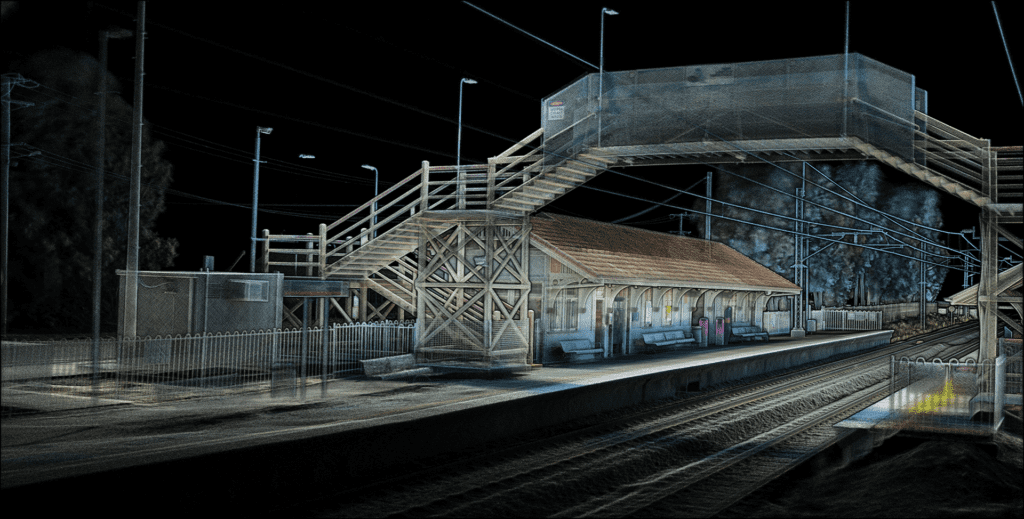
Locations such as train and power stations offer drones their own unique problems with their inclusion of midair high-voltage cables. With Queensland rails systems running 25kV through their above-head power cables, this poses a huge risk to any drone or metal object that positions too closely. For this reason, no objects are allowed within 3 metres of the power cable. This requirement severely restricts drone systems from getting low enough to capture important ground-level details.
The Ground-Based Solution.
Luckily for these applications, there are several ground based solutions capable of mapping where drones can’t go. By employing SLAM systems like the TerrusM, Surveyors are able to rapidly, safely and accurately scan these areas without the need for excessive permits.
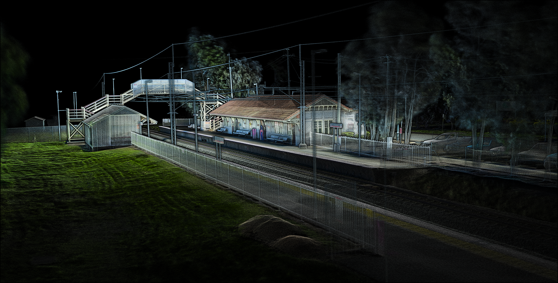
Whether working near airports or creating digital twins of train stations, the system’s 100m LiDAR range ensures the capture of highly detailed data without ever needing to cross the yellow line. Additionally, the system’s compact and easy-to-manoeuvre form allows surveyors to capture every area without the worry of breaking equipment or property.
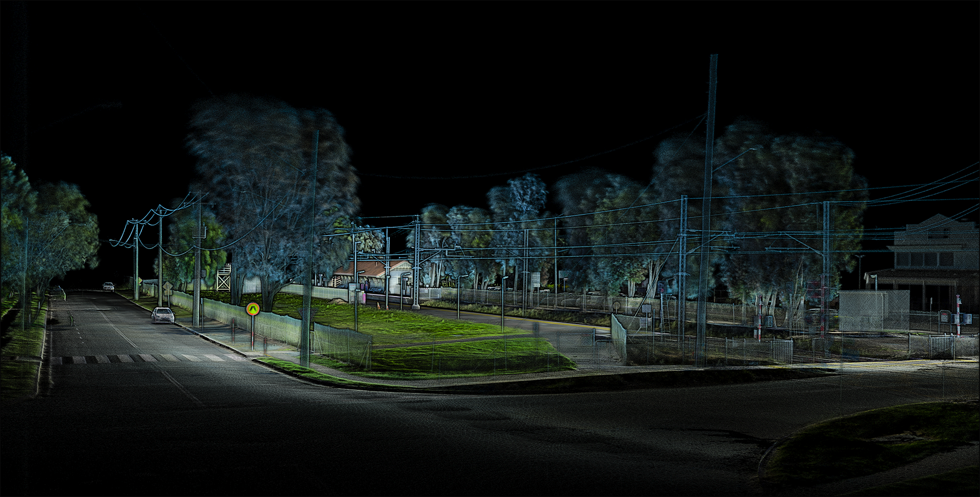
With the exclusion of rain, these rugged ground-based systems are capable of working in most weather and environments. Where a windy or cloudy day may mean postponement for other systems, the TerrusM is good to go.
This combined with the system’s magnetic base allows for it to be attached to several versatile accessories and vehicles. These attachments allow the SLAM systems to capture the full environment at similar times to that of drone based systems.
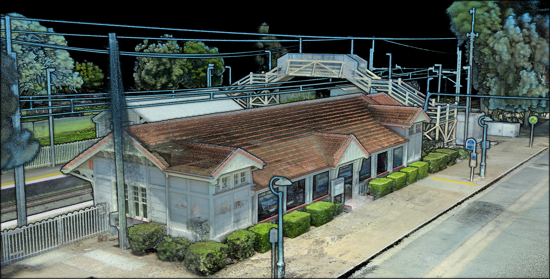
Another benefit of utilising these ground-based systems is that of on-site safety auditing. Due to the system’s LiDAR and 360 alignment software, captured points clouds are able to be processed in full HD colour. The benefit of these captures being done at ground level is that it leads to a higher detailed capture of on-site furniture such as signage. These details are often missed by fast-moving drone SLAM systems. This readable detail allows off-site employers to assess and audit their site for equipment, signage and damages without ever needing to leave the office.
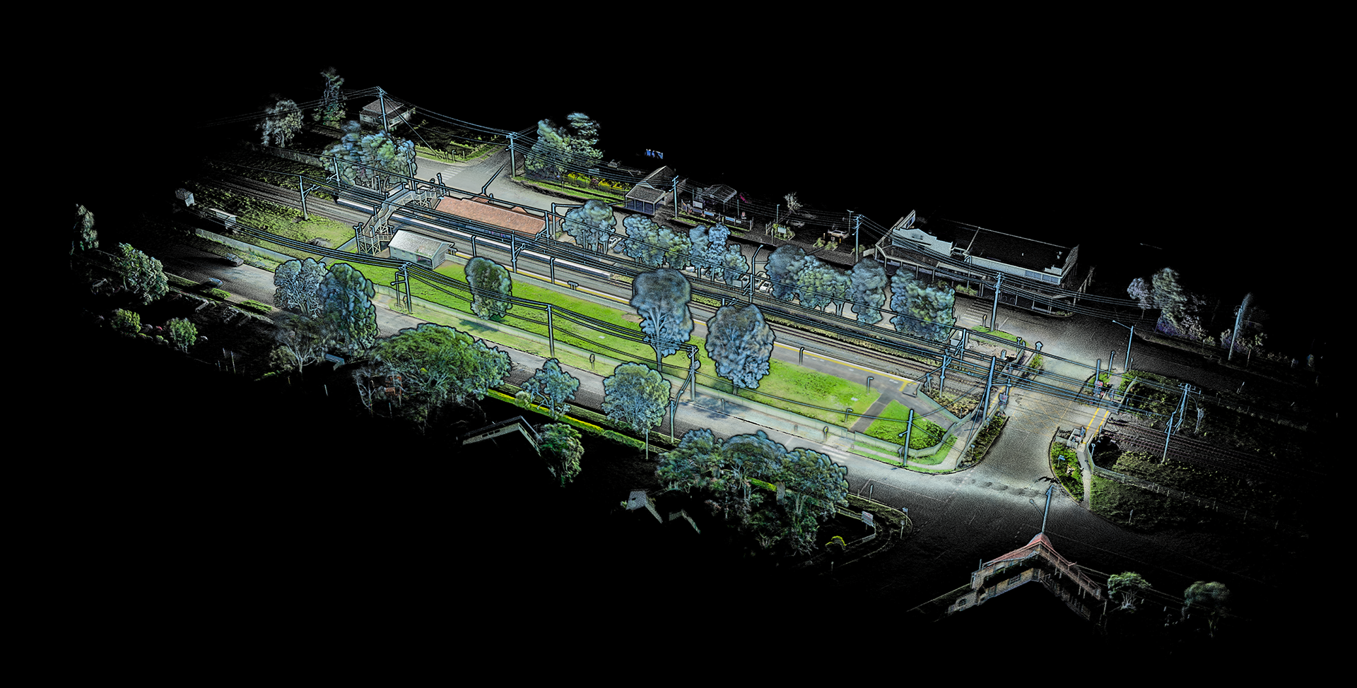
Capturing the Rosewood Train Station
While many people reading this article may already see the uses and benefits of rapidly capturing these complex structures, for those who don’t, let us explain.
Future Planning
Using these collect point clouds users are ableto gather information about the topography of the area to use in both GIS and BIM applications.
Base and Change Mapping
One of the largest uses for these systems is for change detection mapping. Mostly used to assess high-risk or old infrastructure, these systems are used to report movement, drift or missing elements of a structure.
This is done by overlaying two maps of the same area taken over a period of time. This period of time shortens and extends based on risk or how often the area is estimated to change. For example, after a flood, the Walter Taylor Bridge would need to be remapped to assess if there had been any movement or structural changes.
For this reason, rapid turnaround systems such as the TerrusM are useful for surveyors looking for accurate and repeatable data to provide to their clients.
More Information
To keep in the know about AutoMap updates and products, follow us on Linked In, Instagram or Facebook for the latest in SLAM News.


