Ground Capture of Complex Infrastructure Using SLAM Systems

Reading time: 3 Minutes
31/10/22 Written By Shaun Coghlan
Mapping Made Simple
When it comes to capturing large and complex infrastructure, many companies are seeing a slow turn away from static LiDAR Scanners. Trading in their 200+ static setups for an hour of walking, surveyors have celebrated the introduction of many new, exciting and accurate forms of mobile mapping equipment.
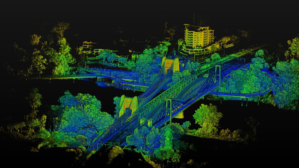
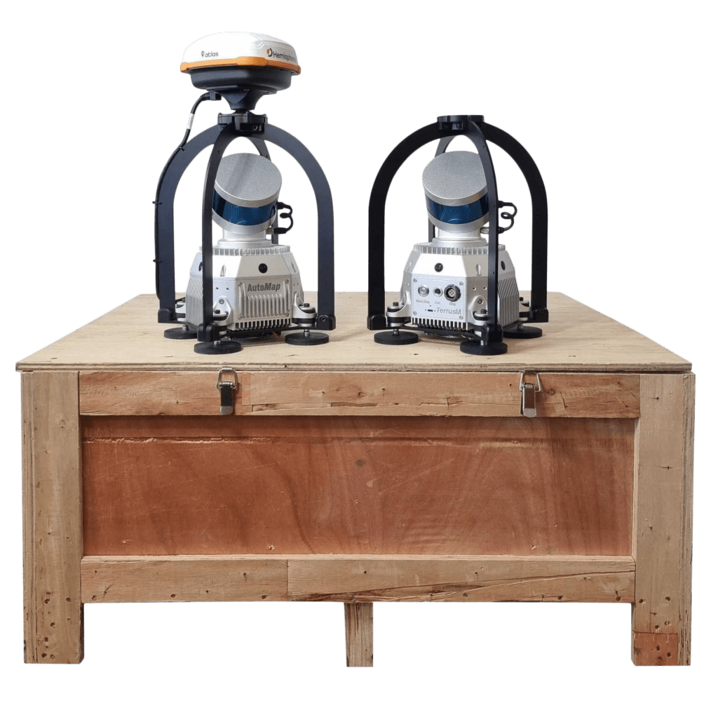
With the vast improvements to both software and hardware over recent years, surveyors are now seeing accuracy through these systems unlike ever before. With systems such as AutoMap’s TerrusM, users are now able to effortlessly capture these complex buildings into stunning 3D point clouds in a manner of minutes.
Additionally, unlike static stations, These systems are beneficial for high-traffic sectors such as bridges and urban cityscapes. Due to their mobile nature, there is no need for the closure of roads or restricting street access.
Capturing the Walter Taylor Bridge
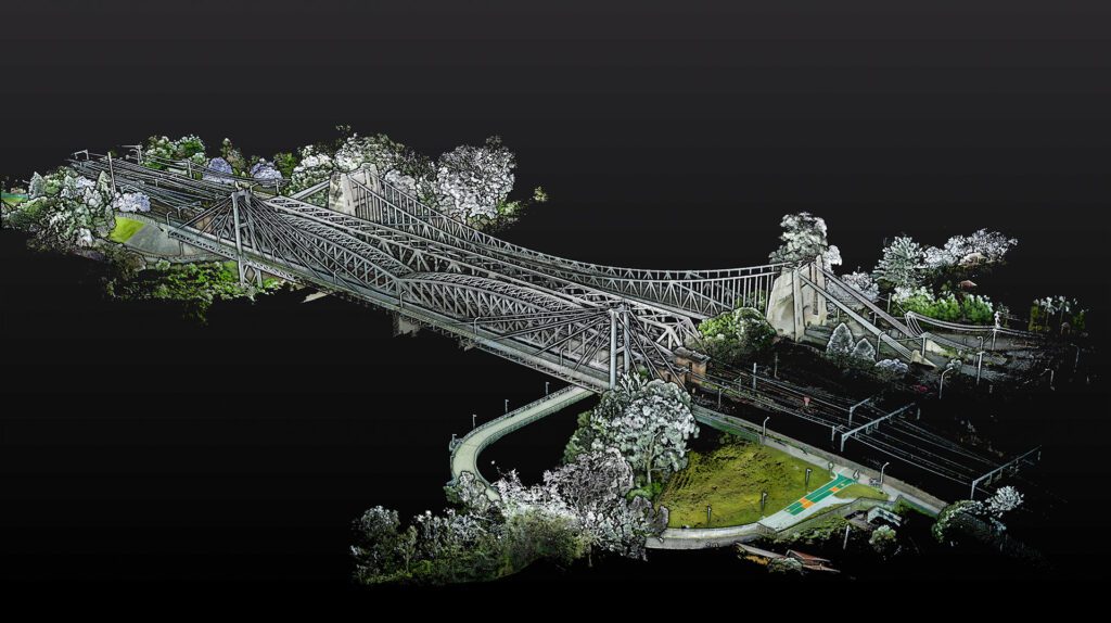
This week AutoMap’s head of marketing Shaun, employed the help of the survey assistant with the aim of capturing Indooroopilly’s “Walter Taylor Bridge”. Before this Chris, the survey assistant had never used a TerrusM or any other mobile SLAM-based system.
Beginning their journey, Chris equipped the TerrusM with a backpack application at the southwest side of the bridge. Taking note of their beginning point, the two commenced the scan and headed towards the underside of the bridge. The reason for capturing the underside first before crossing is to create a “Skeleton” or “base” of the south side of the infrastructure.
When working with SLAM base technology these bases are critical for creating “Loops” in the WildCatSLAM software. Completing small loops of the surrounding areas ensures that the software can calculate the environment and street furniture position from one another. Once enough area has been captured for the base, the duo would move to the southwest side before crossing over the west bridge.
Arriving on the North side, the same pattern of “Base” creation was followed using the river walk to map the underside and surrounding areas. Finally, the two crossed again using the walkway on the east to arrive back to their starting position, closing the loop and completing the scan.
Advantages of a Mobile SLAM Backpack System
Ideal for mapping open outdoor settings, The TerrusM on a backpack application creates a lot of advantages for the user. This compact lightweight setup allows users to access any environment while keeping their hands completely free. While the terminal screen was used to capture the Walter Taylor Bridge, the screen is not required during capture and is only used as a visual aid.
Additionally, the backpack application has been designed to allow for easy setup and pack-down. Allowing users to have their system up and scanning in under 10 minutes.

What’s the Point?!
While many people reading this article may already see the uses and benefits of rapidly capturing these complex structures, for those who don’t, let us explain.
Future Planning
Using these collect point clouds users are about to gather information about the topography of the area to use in both GIS and BIM applications.
Base and Change Mapping
One of the largest uses for these systems is for change detection mapping. Mostly used to assess high-risk or old infrastructure, these systems are used to report movement, drift or missing elements of a structure.
This is done by overlaying two maps of the same area taken over a period of time. This period of time shortens and extends based on risk or how often the area is estimated to change. For example, after a flood, the Walter Taylor Bridge would need to be remapped to assess if there had been any movement or structural changes.
For this reason, rapid turnaround systems such as the TerrusM are useful for surveyors looking for accurate and repeatable data to provide to their clients.
More Information
To keep in the know about AutoMap updates and products, follow us on Linked In, Instagram or Facebook for the latest in SLAM News.


